Draft Regional Development Strategy
agendaNi considers what the next 14 years could hold for Northern Ireland, according to the draft Regional Development Strategy.
Released in January, the draft Regional Development Strategy maps out how Northern Ireland is expected to change up to 2025. It follows on from a 10-year review of the first ‘Shaping our Future’ strategy, which was published in 2001 and amended in 2008. This had been the British Isles’ first spatial strategy.
“Place, where things are and where things happen, can be often overlooked in decision making but it matters to people,” it states.
The final strategy will influence the new Programme for Government, the revised Investment Strategy, and future spending
by departments, councils and the private sector. It is hard to think ahead in an economic crisis, the document admits, but the region must be positioned to make a “speedy recovery”.
Another review will be needed after the 11 new councils are introduced.
Belfast is the closest city for 75 per cent of Northern Ireland’s population, with the rest looking to Derry. If regional development is to be balanced, it must be fit into a ‘spatial framework’ identifying where development should take place outside those two cities.
Nine sub-regional centres are proposed: Ballymena; Coleraine; Cookstown; Craigavon; Downpatrick; Enniskillen; Newry; Newtownards; and Omagh.
These centres can then be clustered with smaller towns, which could share services e.g. a small hospital. Five clusters are proposed:
• Ballymena and Antrim;
• Coleraine, Ballymoney and Ballycastle;
• Cookstown, Dungannon and Magherafelt;
• Craigavon and Banbridge (and possibly Armagh); and
• Newry and Dundalk (cross-border).
Six ‘gateways’ will provide Northern Ireland’s main connections with its neighbours and the wider world:
• Belfast (principal sea port and the City Airport);
• Belfast International Airport;
• Larne (second largest sea port);
• Derry (sea port, regional airport and road links to Donegal);
• Newry (links to Warrenpoint Harbour, Dundalk and Dublin); and
• Enniskillen (links to Sligo).
Four economic corridors can be traced out from these points:
• Eastern seaboard (Larne-Belfast- Newry-Dublin);
• Western (Derry-Omagh-Monaghan);
• Northern (Belfast-Ballymena- Coleraine-Derry); and
• South western (Belfast-Craigavon- Dungannon-Enniskillen-Sligo).
Around 40 per cent of the population live outside these settlements. Fast population growth has reversed a long decline, but the planning system is under pressure as it tries to balance this with the landscape. New technology and telecoms can help deliver services in remote areas, it suggests. Rathlin faces unique challenges, as the province’s only inhabited offshore island.
“The Regional Development Strategy provides an overarching strategic planning framework to facilitate and guide both the public and private sectors,” said Conor Murphy. “The speed and direction of change in our society and economy requires a new approach to spatial development.” The consultation closes on 31 March.
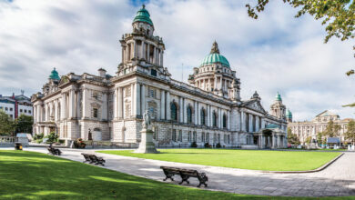
Belfast’s population must grow to reach its potential. An aim of 300,000 residents by 2021 is set, up from 268,400 in 2009. That level was last reached in the 1980s. The Troubles contributed to a long decline, which has continued with growth in the commuter belt.
More housing, a stronger water and waste water network, and an efficient public transport system are vital. Some 22,000 jobs could be created over 2008-2028, mostly in services.
‘Urban villages’ would take shape in inner city areas. All Belfast’s citizens must benefit from wealth creation, it adds. Gateways into the city centre and arterial routes are seen as areas with good potential for housing development.
Derry’s continued regeneration could transform the city and the north west. The Ebrington Barracks and Fort George sites would add 17 hectares of development land. The city also needs 13,700 new houses over 2008-2025 according to revised indicators. An “exceptional landscape setting” contributes to its potential for tourism and the city should be “promoted as a major tourist destination in its own right”.
Transport links through the city centre must be improved, especially to make it easier for passengers to change between bus and rail. Strabane and Limavady are important service centres and both have tourism potential. The north west also has a “significant renewable energy resource” i.e. wind farms.
Reducing car use is prioritised, to tackle the effects of climate change. Eighty per cent of commuters drive to work. When neighbourhoods are being designed, shops, churches and offices etc. should be located near to homes. This would therefore encourage more people to walk, cycle or take public transport in their daily routine.
“The car may be essential for some journeys but its value needs to be weighed against impact on the environment,” it warns. New infrastructure will be needed to power electric vehicles. More energy efficiency in buildings is needed, as around 75 per cent of the current building stock will be standing in 2050.
“More can be achieved through collaboration than competition,” the document states. Public transport links and energy inter-connections are highlighted as two areas which can benefit North and South.
The Dublin-Belfast economic corridor should be developed as the “major driver of growth on this island” and the Derry-Letterkenny gateway can also be unlocked. The potential for a Dublin-North West corridor will also be explored.
The futures of Newry and Dundalk, Derry and Letterkenny, and Enniskillen and Sligo, are “closely inter-related”. Conor Murphy and outgoing Irish Environment Minister Éamon Ó Cuív have launched a joint consultation on a ‘framework for collaboration on spatial
strategies for the island of Ireland’ which closes on 11 April.
Links with Great Britain are “no less important” due to strong cultural and trading ties, the Moyle Interconnector and natural gas pipeline. Ferry routes between Belfast and Larne to Scotland are recognised as “key links” and Liverpool is one of Europe’s largest sea ports. Better connections would encourage tourists to travel between Northern Ireland, Scotland and North West England.
Lisburn’s potential
Five per cent of Northern Ireland’s employment growth over 1998-2008 took place in Lisburn district, a rate set to rise to 10 per cent over 2008-2028. Lisburn is “strategically located at the meeting of key transport corridors” and has a strong city centre for retail. Sprucefield is the province’s only out-of-town regional shopping centre.
Shared spaces
Integrated services and facilities must be developed, the strategy states, so that everyone has a “sense of belonging” when using them. There should be no perceived or physical barriers which stop people from going to those places. A stronger community spirit and sense of place is also needed, and could be achieved if more people took part in the planning process.

